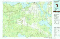
1984 Map of Sault Ste. Marie South
USGS Topo · Published 1991About this map
Sault Ste Marie anchors the northern edge of this 1980s Eastern Upper Peninsula landscape, where the international boundary separates Michigan from Ontario across the St. Marys River. The map documents a transition from the industrial and transport hub of the locks toward the vast woodlands of the Hiawatha National Forest and Lake Superior State Forest. Settlement patterns follow the established corridors of Michigan 28 and the Soo Line RR, connecting timber and agricultural communities like Rudyard and Raco.
Find a feature on this map
290 named features on this map. Tap any name to fly to it.
Don’t see what you’re looking for? This feature index may not catch every label — zoom into the map to look around manually.
Map Details
Editions of this 1984 Sault Ste. Marie South Map
2 editions found
Other maps of this area

1913 · Sault Sainte Marie
USGS Topo · 1:62,500

1919 · Neebish
USGS Topo · 1:62,500

1931 · St Ignace NW
USGS Topo · 1:31,680

1931 · Pickford SE
USGS Topo · 1:31,680

1931 · Epoufette SE
USGS Topo · 1:31,680

1931 · Epoufette NE
USGS Topo · 1:31,680

1931 · Moran NE
USGS Topo · 1:31,680

1931 · Ozark SE
USGS Topo · 1:31,680

1932 · St Ignace NE
USGS Topo · 1:31,680

1941 · Neebish
USGS Topo · 1:63,360