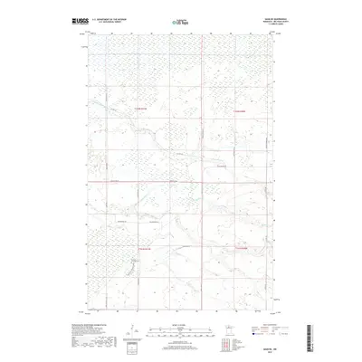
2019 Map of Saum NE
USGS Topo · Published 2019About this map
S Br Battle River and the N Cormorant River wind through this stretch of Beltrami County, defining a landscape shaped by glacial drainage and northern marshlands. The hydrography of the region is further characterized by Meadow Cr and Haden Cr, which meander through various townships including t152n r31w and t151n r30w. Human settlement is sparsely distributed along a network of rural routes such as Cormant Rd NE and Kelliher Rd Ne. For those researching local history, the Cormant Township Cem, located off Pine Ridge Cemetery Rd NE, serves as a primary genealogical landmark within this quiet pocket of northern Minnesota. The grid of forest and section lines is interrupted only by specialized infrastructure like Deep Ditch Rd, reflecting the long-standing efforts to manage the water levels of this lowland terrain.
Find a feature on this map
26 named features on this map. Tap any name to fly to it.
Don’t see what you’re looking for? This feature index may not catch every label — zoom into the map to look around manually.
Map Details
Editions of this 2019 Saum NE Map
This is the sole edition of this map. No revisions or reprints were ever made.
Other maps of this area

1919 · Fox
USGS Topo · 1:62,500

1919 · Quiring
USGS Topo · 1:62,500

1919 · Norden
USGS Topo · 1:62,500

1919 · Bridgie
USGS Topo · 1:62,500

1924 · Bridgie
USGS Topo · 1:62,500

1954 · Bemidji
USGS Topo · 1:250,000

1954 · Roseau
USGS Topo · 1:250,000

1957 · Roseau
USGS Topo · 1:250,000

1957 · Bemidji
USGS Topo · 1:250,000

1958 · Bemidji
USGS Topo · 1:250,000