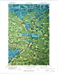
1972 Map of Saum NE
USGS Topo · Published 1974About this map
The Red Lake State Forest dominates this orthophotomap, which utilizes 1969 high-altitude aerial imagery to reveal the complex wetlands and timberlands of northern Minnesota in the early 1970s. This specific survey area is bisected by the Old Indian Treaty Boundary, a historical line that marks the edge of the Red Lake Indian Reservation. The land is defined by its intricate drainage patterns, including the winding Battle River, its South Branch, and Cormorant Creek. Unlike traditional topographic maps, this format provides a direct photographic look at the clearing patterns and swampy reaches across the townships of Woodrow, Kelliher, and Shooks. Human activity is sparse, evidenced primarily by isolated Gravel Pits and the straight-line cuts of logging roads through the dense forest cover.
Find a feature on this map
14 named features on this map. Tap any name to fly to it.
Don’t see what you’re looking for? This feature index may not catch every label — zoom into the map to look around manually.
Map Details
Editions of this 1972 Saum NE Map
This is the sole edition of this map. No revisions or reprints were ever made.
Other maps of this area

1919 · Fox
USGS Topo · 1:62,500

1919 · Quiring
USGS Topo · 1:62,500

1919 · Norden
USGS Topo · 1:62,500

1919 · Bridgie
USGS Topo · 1:62,500

1924 · Bridgie
USGS Topo · 1:62,500

1954 · Bemidji
USGS Topo · 1:250,000

1954 · Roseau
USGS Topo · 1:250,000

1957 · Roseau
USGS Topo · 1:250,000

1957 · Bemidji
USGS Topo · 1:250,000

1958 · Bemidji
USGS Topo · 1:250,000