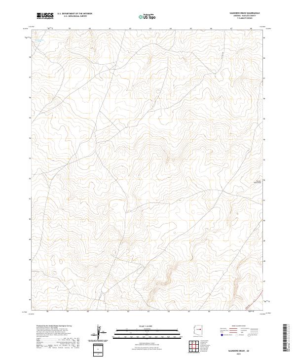
2021 Map of Saunders Draw
USGS Topo · Published 2021About this map
Ranching infrastructure and water management define this landscape in the high desert of Navajo County. The area is characterized by livestock-related features such as Rattlesnake Tank in the northwest and the prominent drainage of Porter Tank Draw to the east. Transportation through this terrain relies on established routes like LX Ranch Rd, which traverses the northern sections, and Heber Rd in the southeast. The land is strictly organized by the Public Land Survey System, dividing the territory into clear townships including t17n r19e and t16n r20e, illustrating the continuing importance of these historical grazing and land management boundaries in contemporary Arizona.
Find a feature on this map
8 named features on this map. Tap any name to fly to it.
Don’t see what you’re looking for? This feature index may not catch every label — zoom into the map to look around manually.
Map Details
Editions of this 2021 Saunders Draw Map
This is the sole edition of this map. No revisions or reprints were ever made.
Other maps of this area

1886 · Holbrook
USGS Topo · 1:250,000

1893 · Holbrook
USGS Topo · 1:250,000

1954 · Holbrook
USGS Topo · 1:250,000

1955 · St. Joseph 2 SE
USGS Topo · 1:24,000
1955 · St. Joseph 2 NW
USGS Topo · 1:24,000

1955 · St. Joseph 1 NW
USGS Topo · 1:24,000
1955 · St. Joseph 2 NE
USGS Topo · 1:24,000

1955 · Joseph City
USGS Topo · 1:62,500
1955 · Holbrook
USGS Topo · 1:62,500

1957 · Holbrook
USGS Topo · 1:250,000