
1959 Map of Savageton
USGS Topo · Published 1961About this map
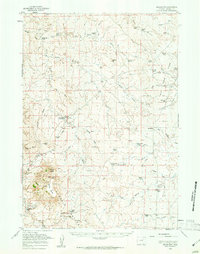
The high plains of Campbell County are dominated by the Pumpkin Buttes in the late 1950s, a landscape defined by an extensive network of ephemeral draws and prongs feeding into Pumpkin Creek. This era reveals a ranching economy where namesake family holdings like the Wagstaff Ranch, Jordan Ranch, and Gilbertz Ranch are connected by unimproved dirt tracks across the sagebrush. At the settlement of Savageton, the community is anchored by the Schlautmann School and St Francis Ch, while a nearby Cem and the Gilkie Ranch (Aband) provide clear evidence of the shifting population patterns of the mid-20th century. Notable landmarks such as Wags Pinnacle and Chimney Hill rise above the drainage of Wild Horse Creek, serving as natural navigational markers in a region where isolated Mines and a private Landing Field hint at the emerging industrial and logistical needs of the Wyoming interior.
Find a feature on this map
60 named features on this map. Tap any name to fly to it.
Don’t see what you’re looking for? This feature index may not catch every label — zoom into the map to look around manually.
Map Details
Editions of this 1959 Savageton Map
2 editions found
Other maps of this area

1953 · Dry Fork Ranch
USGS Topo · 1:24,000

1953 · Fort Reno SE
USGS Topo · 1:24,000

1953 · Savageton
USGS Topo · 1:24,000

1953 · Fats Draw
USGS Topo · 1:24,000

1953 · South Butte
USGS Topo · 1:24,000

1953 · The Nipple
USGS Topo · 1:24,000

1953 · Rolling Pin Ranch
USGS Topo · 1:24,000

1953 · North Butte
USGS Topo · 1:24,000

1954 · Gillette
USGS Topo · 1:250,000

1955 · Newcastle
USGS Topo · 1:250,000