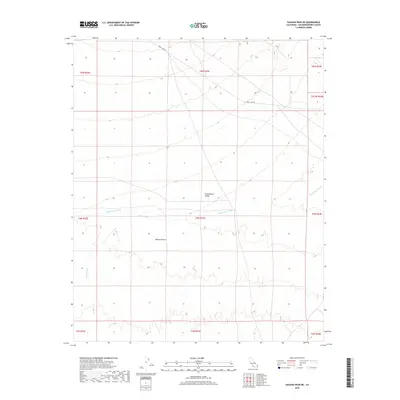
2018 Map of Savahia Peak NE
USGS Topo · Published 2018About this map
Chemehuevi Valley occupies the center of this terrain, where the wide alluvial plains of the Mojave Desert are etched by intermittent drainage systems. The landscape is defined by the significant path of Chemehuevi Wash, which flows eastward toward the Colorado River basin, joined by the smaller Gary Wash in the southwestern quadrant. This modern 2018 survey reveals a sparse desert environment where human activity is largely limited to the utility of Havasu Lake Rd, which cuts across the northern corners of the map. The elevation contours provided by the U.S. Geological Survey illustrate the gradual descent of the valley floor, highlighting how water movement has historically shaped this arid corridor between mountain ranges.
Find a feature on this map
15 named features on this map. Tap any name to fly to it.
Don’t see what you’re looking for? This feature index may not catch every label — zoom into the map to look around manually.
Map Details
Editions of this 2018 Savahia Peak NE Map
This is the sole edition of this map. No revisions or reprints were ever made.
Other maps of this area

1903 · Needles
USGS Topo · 1:125,000

1904 · Needles Special
USGS Topo · 1:125,000

1911 · Parker
USGS Topo · 1:125,000

1943 · Topock
USGS Topo · 1:62,500

1943 · Whipple Mts.
USGS Topo · 1:62,500

1950 · Topock
USGS Topo · 1:62,500

1950 · Sawtooth Range
USGS Topo · 1:62,500

1950 · Whipple Mts
USGS Topo · 1:62,500

1950 · Savahia Peak
USGS Topo · 1:62,500

1951 · Topock
USGS Topo · 1:62,500