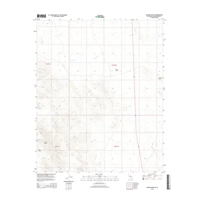
2015 Map of Savahia Peak SW
USGS Topo · Published 2015About this map
Mojave Desert terrain dominates this 2015 survey, revealing the stark geological transitions of eastern San Bernardino County. The landscape is defined by the elevation changes of the Mopah Range in the southwest corner, which gives way to the broad expanse of the Vidal Valley. Water drainage patterns are clearly visible through the ephemeral channel of Gary Wash, which cuts across the northern desert floor. A singular landmark, Pyramid Butte, rises near the eastern edge of the quadrangle, serving as a distinct navigational point in an area characterized by its lack of dense human development. Modern infrastructure is represented primarily by Highway 95, the main north-south arterial that bisects the desert plains, providing the only major connection through this arid region.
Find a feature on this map
10 named features on this map. Tap any name to fly to it.
Don’t see what you’re looking for? This feature index may not catch every label — zoom into the map to look around manually.
Map Details
Editions of this 2015 Savahia Peak SW Map
This is the sole edition of this map. No revisions or reprints were ever made.
Other maps of this area

1943 · Turtle Mts.
USGS Topo · 1:62,500

1943 · Vidal
USGS Topo · 1:62,500

1949 · Vidal
USGS Topo · 1:62,500

1950 · Vidal
USGS Topo · 1:62,500

1950 · Savahia Peak
USGS Topo · 1:62,500

1951 · Savahia Peak
USGS Topo · 1:62,500

1954 · Needles
USGS Topo · 1:250,000

1954 · Turtle Mountains
USGS Topo · 1:62,500

1954 · Rice
USGS Topo · 1:62,500

1956 · Needles
USGS Topo · 1:250,000