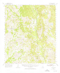
1955 Map of Savannah
USGS Topo · Published 1976About this map
The Wolf River and Crane Creek dominate this mid-century portrait of southern Mississippi, where the landscape is defined by its deep pine forests and scattered rural communities. Established within the De Soto National Forest, the area shows a clear pattern of small settlements such as Savannah, Rowlands, and Necaise connected by a network of unimproved roads and forest trails. The presence of several fire towers, including the Hickman Lookout Tower and Sellers Lookout Tower, underscores the importance of timber management in this era.
Find a feature on this map
43 named features on this map. Tap any name to fly to it.
Don’t see what you’re looking for? This feature index may not catch every label — zoom into the map to look around manually.
Map Details
Editions of this 1955 Savannah Map
Other maps of this area

1914 · Nicholson
USGS Topo · 1:62,500

1921 · Nicholson
USGS Topo · 1:62,500

1947 · Wiggins
USGS Topo · 1:62,500

1949 · Wiggins
USGS Topo · 1:62,500

1953 · Mobile
USGS Topo · 1:250,000

1954 · McHenry
USGS Topo · 1:62,500

1955 · Savannah
USGS Topo · 1:62,500

1956 · Vidalia
USGS Topo · 1:24,000

1956 · Gulfport NW
USGS Topo · 1:24,000

1957 · Mobile
USGS Topo · 1:250,000