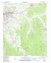
1972 Map of Savannah
USGS Topo · Published 1992About this map
Savannah serves as the focal point of this Tennessee landscape, showing the town's expansion into residential developments like Woodland Heights and New Town during the early 1970s. The geography is defined by the winding course of Horse Creek, which meanders through the central terrain, while the rural eastern portions are characterized by a network of hollows such as Barnett Hollow and Jenkins Hollow.
Find a feature on this map
94 named features on this map. Tap any name to fly to it.
Don’t see what you’re looking for? This feature index may not catch every label — zoom into the map to look around manually.
Map Details
Editions of this 1972 Savannah Map
2 editions found
Other maps of this area

1936 · Savannah
USGS Topo · 1:24,000

1936 · Wolf Pit Ridge
USGS Topo · 1:24,000

1936 · Hookers Bend
USGS Topo · 1:24,000

1936 · Counce
USGS Topo · 1:24,000

1936 · Olivehill
USGS Topo · 1:24,000

1936 · Milledgeville
USGS Topo · 1:24,000

1936 · Pickwick
USGS Topo · 1:24,000

1936 · Lowryville
USGS Topo · 1:24,000

1936 · Pittsburg Landing
USGS Topo · 1:24,000

1949 · Hookers Bend
USGS Topo · 1:24,000