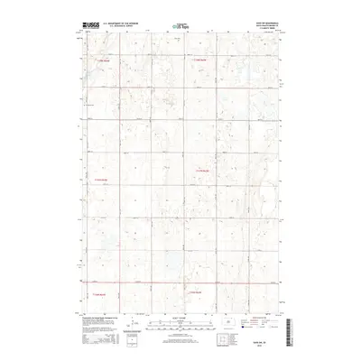
2015 Map of Savo SW
USGS Topo · Published 2015About this map
The Maple River meanders through this portion of Brown County, defining the drainage patterns of a landscape marked by the precise grid of the Public Land Survey System. Located near the North Dakota border, the area is anchored by the Savo Cem in the north and Frederick Cem to the west, serving as important landmarks for local genealogy and township history. The map detail reflects the rural character of Frederick Township, where the section lines of t128n r64w and t127n r63w govern the placement of local roads like 387th Ave and 105th St. This 2015 survey provides a clear view of the prairie potholes and wetland depressions characteristic of the region's topography.
Find a feature on this map
23 named features on this map. Tap any name to fly to it.
Don’t see what you’re looking for? This feature index may not catch every label — zoom into the map to look around manually.
Map Details
Editions of this 2015 Savo SW Map
This is the sole edition of this map. No revisions or reprints were ever made.
Other maps of this area

1894 · Ellendale
USGS Topo · 1:62,500

1894 · Columbia
USGS Topo · 1:62,500

1894 · Savo
USGS Topo · 1:62,500

1896 · Columbia
USGS Topo · 1:125,000

1899 · Ellendale
USGS Topo · 1:125,000

1952 · Columbia NE
USGS Topo · 1:24,000

1952 · Westport
USGS Topo · 1:24,000

1952 · Richmond NE
USGS Topo · 1:24,000

1953 · Savo SW
USGS Topo · 1:24,000

1953 · Frederick
USGS Topo · 1:24,000