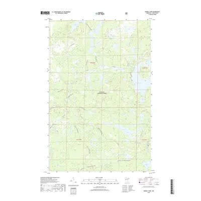
2019 Map of Sawbill Camp
USGS Topo · Published 2019About this map
Superior National Forest defines the landscape of this region in the late 2010s, where an intricate network of glacial lakes and portage routes serves as the primary infrastructure. The area around Sawbill Camp acts as a gateway to these water bodies, which include Kelly Lake, Burnt Lake, and the expansive Crescent Lake. The map illustrates a shift in land use towards recreational conservation, with specialized infrastructure such as the Screech Road Bike Trail and the Pancore Lake Bike Trail replacing the older industrial footprints of the north woods. Evidence of historical transportation persists through named corridors like The Grade and Temperance Trestle Rd, providing a window into the era of rail-based timber extraction. From White Pine Lake to the Clara Lake Boat Access, the map meticulously documents the shoreline configurations and access points critical for navigating this water-dominant terrain.
Find a feature on this map
60 named features on this map. Tap any name to fly to it.
Don’t see what you’re looking for? This feature index may not catch every label — zoom into the map to look around manually.
Map Details
Editions of this 2019 Sawbill Camp Map
This is the sole edition of this map. No revisions or reprints were ever made.
Other maps of this area

1919 · Brule Lake
USGS Topo · 1:62,500

1919 · Lutsen
USGS Topo · 1:62,500

1954 · Two Harbors
USGS Topo · 1:250,000

1955 · Tofte
USGS Topo · 1:62,500

1957 · Two Harbors
USGS Topo · 1:250,000

1958 · Two Harbors
USGS Topo · 1:250,000

1959 · Lutsen
USGS Topo · 1:24,000

1960 · Tait Lake
USGS Topo · 1:24,000

1960 · Sawbill Camp
USGS Topo · 1:24,000

1960 · Brule Lake
USGS Topo · 1:24,000