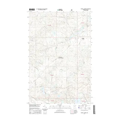
2016 Map of Sawbill Landing
USGS Topo · Published 2016About this map
Superior National Forest dominates this landscape, where the DMIR Grade cuts through a dense network of lakes and small waterways. The terrain is defined by the headwaters and drainages of the Dumbbell River and the Little Isabella River, illustrating the complex hydrology of northern Lake County. Sawbill Landing appears as the primary point of settlement, connected to the surrounding wilderness by routes such as Sapphire Lake Rd and numerous forest trails. A concentration of smaller bodies of water, including Finn Pond, Odeima Lake, and Eighteen Lake, highlights the localized wetland patterns typical of the region. The map captures the intersection of early industrial transportation routes, like the railroad grade, with contemporary forest management and conservation boundaries.
Find a feature on this map
41 named features on this map. Tap any name to fly to it.
Don’t see what you’re looking for? This feature index may not catch every label — zoom into the map to look around manually.
Map Details
Editions of this 2016 Sawbill Landing Map
This is the sole edition of this map. No revisions or reprints were ever made.
Other maps of this area

1954 · Two Harbors
USGS Topo · 1:250,000

1955 · Isabella
USGS Topo · 1:62,500

1955 · Cramer
USGS Topo · 1:62,500

1957 · Two Harbors
USGS Topo · 1:250,000

1958 · Two Harbors
USGS Topo · 1:250,000

1960 · Perent Lake
USGS Topo · 1:24,000

1964 · Two Harbors
USGS Topo · 1:250,000
1981 · Silver Island Lake
USGS Topo · 1:24,000
1981 · Isabella
USGS Topo · 1:24,000
1981 · Mitawan Lake
USGS Topo · 1:24,000