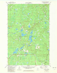
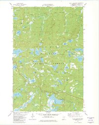
1981 Map of Mitawan Lake
USGS Topo · Published 1982About this map
Stony River Superior National Forest dominates this landscape, characterized by an intricate network of glacial lakes and marshy drainage basins. The presence of the Duluth and Iron Range Railroad (Abandoned) crossing the southeastern corner points to the region's earlier industrial logging history, while the 1980s recreation economy is evident through the Environmental Center (USFS) and numerous trails. Waterways such as the Little Isabella River and Inga Creek connect larger basins like Mitawan Lake and Gegoka Lake. Unique local nomenclature is visible in features like Steamhaul Lake, likely referencing the specialized machinery once used to move timber through these woods. The transition from industrial resource extraction to protected forest management is captured here, with established sites like a Picnic Area, Campground, and Boat Ramp supporting modern wilderness access alongside old railroad grades.
Find a feature on this map
40 named features on this map. Tap any name to fly to it.
Don’t see what you’re looking for? This feature index may not catch every label — zoom into the map to look around manually.
Map Details
Editions of this 1981 Mitawan Lake Map
2 editions found
Other maps of this area

1954 · Greenwood Lake
USGS Topo · 1:62,500

1954 · Two Harbors
USGS Topo · 1:250,000

1955 · Isabella
USGS Topo · 1:62,500

1957 · Two Harbors
USGS Topo · 1:250,000

1957 · Gabbro Lake
USGS Topo · 1:62,500

1958 · Two Harbors
USGS Topo · 1:250,000

1964 · Two Harbors
USGS Topo · 1:250,000
1981 · Gabbro Lake
USGS Topo · 1:24,000
1981 · Isabella
USGS Topo · 1:24,000
1981 · Slate Lake East
USGS Topo · 1:24,000