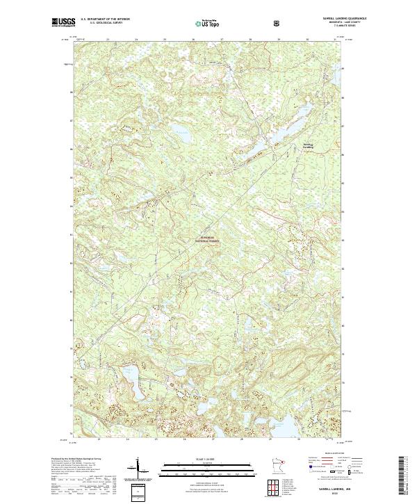
2022 Map of Sawbill Landing
USGS Topo · Published 2022About this map
Sawbill Landing sits at the heart of this Northwoods landscape, serving as a focal point for the complex network of logging and forest service roads within the Superior National Forest. The map documents a terrain defined by its glacial hydrology, featuring a dense concentration of named water bodies such as Eighteen Lake, Tomlinson Lake, and the winding course of the Dumbbell River. This 2022 survey illustrates the modern infrastructure of the timber industry and recreational access, shown through specifically designated sites like the Eighteen Lake Boat Access and numerous specialized spurs including Dumbbell River Spur H and Trappers Lake Spur A. Traces of the region's industrial past are visible in the DM&IR Grade, indicating the historical footprint of the Duluth, Missabe and Iron Range Railway in transporting the area's natural resources.
Find a feature on this map
51 named features on this map. Tap any name to fly to it.
Don’t see what you’re looking for? This feature index may not catch every label — zoom into the map to look around manually.
Map Details
Editions of this 2022 Sawbill Landing Map
This is the sole edition of this map. No revisions or reprints were ever made.
Other maps of this area

1954 · Two Harbors
USGS Topo · 1:250,000

1955 · Isabella
USGS Topo · 1:62,500

1955 · Cramer
USGS Topo · 1:62,500

1957 · Two Harbors
USGS Topo · 1:250,000

1958 · Two Harbors
USGS Topo · 1:250,000

1960 · Perent Lake
USGS Topo · 1:24,000

1964 · Two Harbors
USGS Topo · 1:250,000
1981 · Silver Island Lake
USGS Topo · 1:24,000
1981 · Isabella
USGS Topo · 1:24,000
1981 · Mitawan Lake
USGS Topo · 1:24,000
Featured Places
- Stony River Township, MN
- Crystal Bay Township, MN
- Sawbill Landing, MN
- Wheeler Landing, MN
- Martin Landing, MN