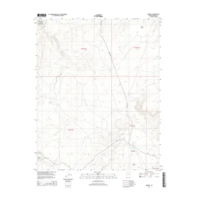
2014 Map of Sawmill
USGS Topo · Published 2014About this map
Sawmill serves as the primary hub of activity in this high-altitude landscape within the Defiance Plateau. The settlement is positioned along the western edge of the plateau where the terrain begins its complex descent toward the Canyon De Chelly National Monument, visible in the northwest corner. This 2014 survey reveals a land defined by its water sources, both natural and engineered, including Tokezie Spring, Kailcheebito Spring, and the Quartzite Wash Reservoir.
Find a feature on this map
22 named features on this map. Tap any name to fly to it.
Don’t see what you’re looking for? This feature index may not catch every label — zoom into the map to look around manually.
Map Details
Editions of this 2014 Sawmill Map
This is the sole edition of this map. No revisions or reprints were ever made.
Other maps of this area

1886 · Fort Defiance
USGS Topo · 1:250,000

1892 · Fort Defiance
USGS Topo · 1:250,000

1892 · Canyon De Chelly
USGS Topo · 1:250,000

1954 · Shiprock
USGS Topo · 1:250,000

1954 · Gallup
USGS Topo · 1:250,000

1955 · Zith-Tusayan Butte 2 SE
USGS Topo · 1:24,000

1955 · Zith-Tusayan Butte 2 NE
USGS Topo · 1:24,000

1955 · Zith-Tusayan Butte 1 SE
USGS Topo · 1:24,000

1955 · Sonsala Butte 4 SE
USGS Topo · 1:24,000

1955 · Sonsala Butte 3 SE
USGS Topo · 1:24,000