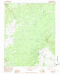
1982 Map of Sawmill
USGS Topo · Published 1983About this map
Sawmill sits at the heart of this high-elevation landscape within the Navajo Indian Reservation during the early 1980s. The settlement's infrastructure is clearly defined, featuring a Cem, Sewage Ponds, and a Rodeo Ground Corral that speaks to the local community's way of life. The terrain is marked by intermittent waterways such as White Clay Wash and Ruia Wash, while the surrounding heights are punctuated by distinctive landmarks like Red Butte and the Lookout Tower near Fluted Rock Lake. To the northwest, the map captures the edge of the Canyon De Chelly National Monument. This survey documents a critical transition in land use and utility development, evidenced by the prominent Steel Towers Trans Lines cutting across the high country, contrasting with traditional water sources like Kailcheebito Spring and Tohatchai Spring.
Find a feature on this map
16 named features on this map. Tap any name to fly to it.
Don’t see what you’re looking for? This feature index may not catch every label — zoom into the map to look around manually.
Map Details
Editions of this 1982 Sawmill Map
This is the sole edition of this map. No revisions or reprints were ever made.
Other maps of this area

1886 · Fort Defiance
USGS Topo · 1:250,000

1892 · Fort Defiance
USGS Topo · 1:250,000

1892 · Canyon De Chelly
USGS Topo · 1:250,000

1954 · Shiprock
USGS Topo · 1:250,000

1954 · Gallup
USGS Topo · 1:250,000

1955 · Zith-Tusayan Butte 2 SE
USGS Topo · 1:24,000

1955 · Zith-Tusayan Butte 2 NE
USGS Topo · 1:24,000

1955 · Zith-Tusayan Butte 1 SE
USGS Topo · 1:24,000

1955 · Sonsala Butte 4 SE
USGS Topo · 1:24,000

1955 · Sonsala Butte 3 SE
USGS Topo · 1:24,000