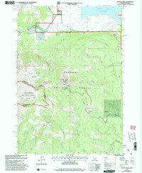
1997 Map of Sawtell Peak
USGS Topo · Published 2002About this map
Sawtell Peak stands as a prominent landmark on this high-altitude landscape, where the Continental Divide forms the natural and political boundary between Idaho and Montana. This 1997 revision of earlier 1964 surveys illustrates the intricate drainage systems and watershed management within the Targhee National Forest and Beaverhead National Forest. The map documents a rugged terrain defined by significant elevation changes, from the shores of Henrys Lake in the north to the isolated heights of Arange Peak in the south.
Find a feature on this map
32 named features on this map. Tap any name to fly to it.
Don’t see what you’re looking for? This feature index may not catch every label — zoom into the map to look around manually.
Map Details
Editions of this 1997 Sawtell Peak Map
This is the sole edition of this map. No revisions or reprints were ever made.
Other maps of this area

1950 · Upper Red Rock Lake
USGS Topo · 1:62,500

1955 · Ashton
USGS Topo · 1:250,000

1958 · Ashton
USGS Topo · 1:250,000

1960 · Ashton
USGS Topo · 1:250,000

1964 · Island Park
USGS Topo · 1:24,000

1964 · Island Park Dam
USGS Topo · 1:24,000

1964 · Targhee Pass
USGS Topo · 1:24,000

1964 · Targhee Peak
USGS Topo · 1:24,000

1964 · Sawtell PK
USGS Topo · 1:24,000

1964 · Big Springs
USGS Topo · 1:24,000