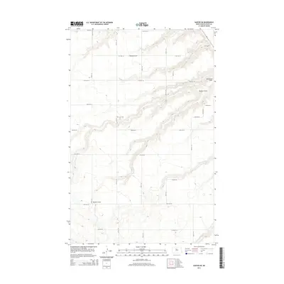
2014 Map of Sawyer SW
USGS Topo · Published 2014About this map
Center Cem sits on a high, level plateau in this corner of Ward County, surrounded by a regular grid of section roads like 55th St SE and 163rd Ave SE. The landscape is defined by the sharp transition from these flat uplands into the deep, winding drainage systems that cut through the plains. The northern half of the map is dominated by the intricate network of Mostad Coulee and Blackwater Coulee, while Burkley Coulee carves its way through both the western and eastern reaches. These landforms reveal the erosional patterns of the prairie, where water has historically shaped the travel routes and field boundaries of the region. In the southeast corner, the terrain softens near the banks of Oak Cr, which meanders through the lower elevations below the 219th Ave SE corridor.
Find a feature on this map
24 named features on this map. Tap any name to fly to it.
Don’t see what you’re looking for? This feature index may not catch every label — zoom into the map to look around manually.
Map Details
Editions of this 2014 Sawyer SW Map
This is the sole edition of this map. No revisions or reprints were ever made.
Other maps of this area

1928 · Minot
USGS Topo · 1:62,500

1929 · Sawyer
USGS Topo · 1:62,500

1929 · Benedict
USGS Topo · 1:62,500

1948 · Sawyer
USGS Topo · 1:24,000

1948 · Surrey
USGS Topo · 1:24,000

1949 · Sawyer
USGS Topo · 1:24,000

1949 · Sawyer NE
USGS Topo · 1:24,000

1949 · Surrey
USGS Topo · 1:24,000

1949 · Minot
USGS Topo · 1:24,000

1949 · Sawyer
USGS Topo · 1:62,500