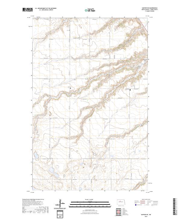
2024 Map of Sawyer SW
USGS Topo · Published 2024About this map
Mostad Coulee cuts a deep, winding path across the northern reaches of this Ward County landscape, characterizing the drainage patterns that define this part of the Great Plains. The map reveals a strictly gridded section-line road network, where routes like 107th Ave SE and 42nd St SE traverse the open plateaus between the coulees. For those researching local heritage, the inclusion of Willis Cem and Saint Peters Lutheran Cem provides precise locations for early community gathering points and resting places. This modern survey, anchored by Co Hwy 20 in the southwest, documents the persistent agricultural divisions of the Public Land Survey System, showing the township and range boundaries that have organized this territory since its initial settlement.
Find a feature on this map
29 named features on this map. Tap any name to fly to it.
Don’t see what you’re looking for? This feature index may not catch every label — zoom into the map to look around manually.
Map Details
Editions of this 2024 Sawyer SW Map
This is the sole edition of this map. No revisions or reprints were ever made.
Other maps of this area

1928 · Minot
USGS Topo · 1:62,500

1929 · Sawyer
USGS Topo · 1:62,500

1929 · Benedict
USGS Topo · 1:62,500

1948 · Sawyer
USGS Topo · 1:24,000

1948 · Surrey
USGS Topo · 1:24,000

1949 · Sawyer
USGS Topo · 1:24,000

1949 · Sawyer NE
USGS Topo · 1:24,000

1949 · Surrey
USGS Topo · 1:24,000

1949 · Minot
USGS Topo · 1:24,000

1949 · Sawyer
USGS Topo · 1:62,500