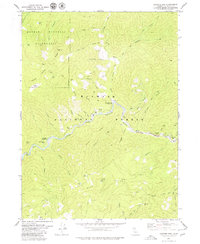
1979 Map of Sawyers Bar
USGS Topo · Published 1979About this map
The North Fork Salmon River carves a deep path through the heart of the Klamath National Forest, defining a landscape where industrial gold mining and early California settlement left a permanent mark. Near the eastern edge, the community of Sawyers Bar serves as the primary hub, situated just downstream from the historic Bestville (Site). The river corridor is a chronicle of mineral extraction, evidenced by extensive Dredge Tailings and numerous named workings such as the New Diggings Mine, Hickey Mine, and Gellia Mine.
Find a feature on this map
73 named features on this map. Tap any name to fly to it.
Don’t see what you’re looking for? This feature index may not catch every label — zoom into the map to look around manually.
Map Details
Editions of this 1979 Sawyers Bar Map
2 editions found
Other maps of this area

1948 · Weed
USGS Topo · 1:250,000

1950 · Weed
USGS Topo · 1:250,000

1955 · Salmon Mtn
USGS Topo · 1:62,500

1955 · Cecilville
USGS Topo · 1:62,500

1955 · Sawyers Bar
USGS Topo · 1:62,500

1955 · Forks of Salmon
USGS Topo · 1:62,500

1958 · Weed
USGS Topo · 1:250,000

1963 · Weed
USGS Topo · 1:250,000
1977 · Yellow Dog Peak
USGS Topo · 1:24,000
1977 · Tanners Peak
USGS Topo · 1:24,000