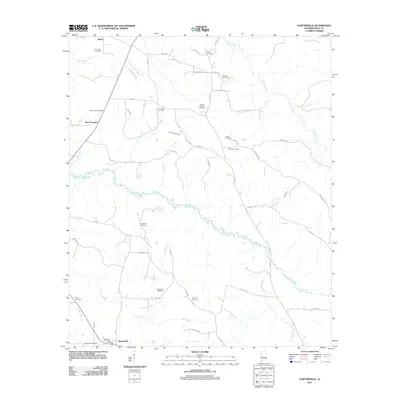
2011 Map of Sawyerville
USGS Topo · Published 2011About this map
Akron and Sawyerville anchor this portion of Hale County, where the landscape is defined by the winding course of Big Brush Creek and its many tributaries. The area maintains a rural character, with numerous family and community burial grounds scattered across the terrain, such as Mount Hebron Cemetery and Langham Cemetery. In the south, the Sawyerville Post Office serves as a local landmark near Bethlehem Cemetery, while the northern portion is marked by the rail-influenced layout of Akron.
Find a feature on this map
54 named features on this map. Tap any name to fly to it.
Don’t see what you’re looking for? This feature index may not catch every label — zoom into the map to look around manually.
Map Details
Editions of this 2011 Sawyerville Map
This is the sole edition of this map. No revisions or reprints were ever made.
Other maps of this area

1927 · Eutaw
USGS Topo · 1:48,000

1931 · Eutaw
USGS Topo · 1:62,500

1947 · Mason Bend
USGS Topo · 1:24,000

1948 · Mason Bend
USGS Topo · 1:24,000

1953 · Montgomery
USGS Topo · 1:250,000

1956 · Montgomery
USGS Topo · 1:250,000

1957 · Montgomery
USGS Topo · 1:250,000

1979 · Greensboro
USGS Topo · 1:24,000

1980 · Ingram
USGS Topo · 1:24,000
1980 · Moundville West
USGS Topo · 1:24,000