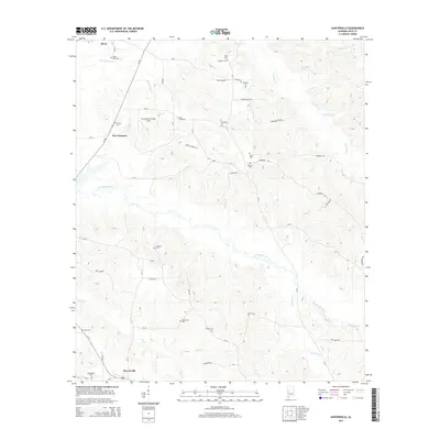
2014 Map of Sawyerville
USGS Topo · Published 2014About this map
Akron and the surrounding rural stretches of Hale County are defined by a network of creeks and small family cemeteries that speak to generations of local settlement. The landscape is carved by the tributaries of Big Brush Creek and Fivemile Cr, including the distinctive Chalaybeate Spring near the northeastern boundary. In this part of the Alabama Black Belt, the distribution of names like Strickland/Smalley Field and over a dozen small burial grounds—such as Mt Zion Cem, Langham Cem, and Bethlehem Cem—offers a clear view of the dispersed agricultural community. Modern roadway improvements like Al-60 and Al-14 connect the smaller communities of New Prospect and Sawyerville, tracing paths through the drainage basins of Pole Bridge Br and Colwell Cr. This survey documents a quiet interior geography where land use remains closely tied to the natural watercourses.
Find a feature on this map
60 named features on this map. Tap any name to fly to it.
Don’t see what you’re looking for? This feature index may not catch every label — zoom into the map to look around manually.
Map Details
Editions of this 2014 Sawyerville Map
This is the sole edition of this map. No revisions or reprints were ever made.
Other maps of this area

1927 · Eutaw
USGS Topo · 1:48,000

1931 · Eutaw
USGS Topo · 1:62,500

1947 · Mason Bend
USGS Topo · 1:24,000

1948 · Mason Bend
USGS Topo · 1:24,000

1953 · Montgomery
USGS Topo · 1:250,000

1956 · Montgomery
USGS Topo · 1:250,000

1957 · Montgomery
USGS Topo · 1:250,000

1979 · Greensboro
USGS Topo · 1:24,000

1980 · Ingram
USGS Topo · 1:24,000
1980 · Moundville West
USGS Topo · 1:24,000