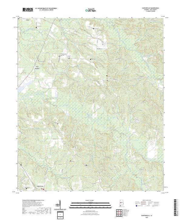
2024 Map of Sawyerville
USGS Topo · Published 2024About this map
Sawyerville and the southern edge of Akron anchor this part of Hale County, where the landscape is defined by a dense network of local creeks and small family cemeteries. Numerous burial sites including Williams Cem, Mount Zion Cem, and Robertson Cem are scattered throughout the wooded terrain, providing a valuable record of rural settlement patterns. The map detail follows the path of Big Brush Creek and Dry Creek as they wind through the township divisions of T21N and T22N. Notable landmarks like Chalybeate Spring and the Strickland/Smalley Field punctuate the ridges between the waterways. The layout of the road system, from AL Highway 14 to smaller routes like Lonesome Dove Rd, reveals the enduring rural character of this Alabama community.
Find a feature on this map
62 named features on this map. Tap any name to fly to it.
Don’t see what you’re looking for? This feature index may not catch every label — zoom into the map to look around manually.
Map Details
Editions of this 2024 Sawyerville Map
This is the sole edition of this map. No revisions or reprints were ever made.
Other maps of this area

1927 · Eutaw
USGS Topo · 1:48,000

1931 · Eutaw
USGS Topo · 1:62,500

1947 · Mason Bend
USGS Topo · 1:24,000

1948 · Mason Bend
USGS Topo · 1:24,000

1953 · Montgomery
USGS Topo · 1:250,000

1956 · Montgomery
USGS Topo · 1:250,000

1957 · Montgomery
USGS Topo · 1:250,000

1979 · Greensboro
USGS Topo · 1:24,000

1980 · Ingram
USGS Topo · 1:24,000
1980 · Moundville West
USGS Topo · 1:24,000