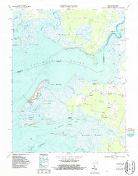
1968 Map of Saxis
USGS Topo · Published 1987About this map
Saxis Island defines this section of the Eastern Shore, where the town of Saxis is surrounded by the expansive wetlands of Freeschool Marsh and Pocomoke Sound. This 1960s landscape records a coastal economy rooted in the water, evidenced by numerous landings like Hammock Landing Creek, Flag Pond Landing, and Shad Landing. The complex network of guts and creeks, such as Starling Creek and Mantuan Gut, highlights the intricate relationship between the land and the Chesapeake tides.
Find a feature on this map
74 named features on this map. Tap any name to fly to it.
Don’t see what you’re looking for? This feature index may not catch every label — zoom into the map to look around manually.
Map Details
Editions of this 1968 Saxis Map
3 editions found
Other maps of this area

1903 · Crisfield
USGS Topo · 1:62,500

1903 · Deal Island
USGS Topo · 1:62,500

1920 · Crisfield
USGS Topo · 1:62,500

1942 · Chesconessex
USGS Topo · 1:31,680

1942 · Marion
USGS Topo · 1:24,000

1942 · Kingston
USGS Topo · 1:24,000

1942 · Mappsville
USGS Topo · 1:24,000

1942 · Saxis
USGS Topo · 1:24,000

1942 · Parksley
USGS Topo · 1:24,000

1943 · Parksley
USGS Topo · 1:31,680