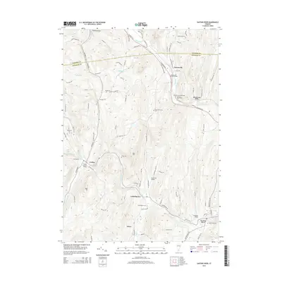
2015 Map of Saxtons River
USGS Topo · Published 2015About this map
The Williams River and Saxtons River define the settlement patterns of this Vermont landscape, where narrow valleys have long dictated the placement of towns and transit routes. Villages such as Grafton, Cambridgeport, and Bartonsville are linked by winding roads like the Green Mountain Tpke and VT Route 103 S. The region’s architectural heritage is highlighted by several structures, including the Bartonsville Covered Bridge and the Kidder Covered Bridge, which cross the primary waterways.
Find a feature on this map
92 named features on this map. Tap any name to fly to it.
Don’t see what you’re looking for? This feature index may not catch every label — zoom into the map to look around manually.
Map Details
Editions of this 2015 Saxtons River Map
This is the sole edition of this map. No revisions or reprints were ever made.
Other maps of this area

1926 · Claremont
USGS Topo · 1:62,500

1927 · Bellows Falls
USGS Topo · 1:48,000

1928 · Ludlow
USGS Topo · 1:48,000

1929 · Claremont
USGS Topo · 1:62,500

1929 · Ludlow
USGS Topo · 1:62,500

1930 · Saxtons River
USGS Topo · 1:48,000

1930 · Bellows Falls
USGS Topo · 1:62,500

1932 · Ludlow
USGS Topo · 1:62,500

1933 · Saxtons River
USGS Topo · 1:62,500

1950 · Glens Falls
USGS Topo · 1:250,000