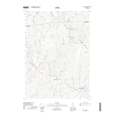
2018 Map of Saxtons River
USGS Topo · Published 2018About this map
Grafton and Saxtons River anchor this Windham County landscape, where the historical settlement pattern follows the narrow valley floors of the Williams River and its south branch. The terrain is defined by steep ridges like Bear Hill and Bull Hill, which forced early roads and infrastructure into the river corridors. Notable engineering landmarks of the region's heritage include the Bartonsville Covered Bridge and the Kidder Covered Bridge, while the Green Mountain RR tracks trace the winding path of the water. Small hamlets and former mill sites such as Brockways Mills and Cambridgeport are documented alongside numerous family and community burial grounds, including the Burgess Cem and the Wright - Bartonsville Cem. In the northwest corner, the curiously named Popple Dungeon marks a remote upland drainage area near the Windsor County line.
Find a feature on this map
88 named features on this map. Tap any name to fly to it.
Don’t see what you’re looking for? This feature index may not catch every label — zoom into the map to look around manually.
Map Details
Editions of this 2018 Saxtons River Map
This is the sole edition of this map. No revisions or reprints were ever made.
Other maps of this area

1926 · Claremont
USGS Topo · 1:62,500

1927 · Bellows Falls
USGS Topo · 1:48,000

1928 · Ludlow
USGS Topo · 1:48,000

1929 · Claremont
USGS Topo · 1:62,500

1929 · Ludlow
USGS Topo · 1:62,500

1930 · Saxtons River
USGS Topo · 1:48,000

1930 · Bellows Falls
USGS Topo · 1:62,500

1932 · Ludlow
USGS Topo · 1:62,500

1933 · Saxtons River
USGS Topo · 1:62,500

1950 · Glens Falls
USGS Topo · 1:250,000