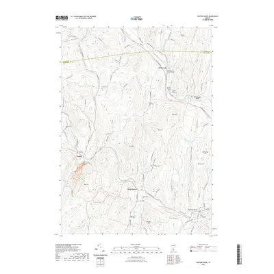
2021 Map of Saxtons River
USGS Topo · Published 2021About this map
The Williams River and Saxtons River wind through this part of Windsor and Windham counties, shaping a landscape of deep valleys and prominent heights like Bull Hill and Shepard Hill. This 2021 edition provides a contemporary record of several small Vermont communities, including Bartonsville, Athens, and the village of Grafton. A significant concentration of historical architecture is preserved through the mapping of the Bartonsville Covered Bridge, Worralls Covered Bridge, and Kidder Covered Bridge. These spans, along with numerous burial grounds such as Wright Cem and Saxtons River Cem, offer a rich layer of data for local historians and genealogists. The road network, including the Green Mountain Tpke and Popple Dungeon Rd, connects these upland settlements, while water bodies like Petty Brook and Hitchcock Brook define the local drainage patterns near Brockways Mills and Cambridgeport.
Find a feature on this map
104 named features on this map. Tap any name to fly to it.
Don’t see what you’re looking for? This feature index may not catch every label — zoom into the map to look around manually.
Map Details
Editions of this 2021 Saxtons River Map
This is the sole edition of this map. No revisions or reprints were ever made.
Other maps of this area

1926 · Claremont
USGS Topo · 1:62,500

1927 · Bellows Falls
USGS Topo · 1:48,000

1928 · Ludlow
USGS Topo · 1:48,000

1929 · Claremont
USGS Topo · 1:62,500

1929 · Ludlow
USGS Topo · 1:62,500

1930 · Saxtons River
USGS Topo · 1:48,000

1930 · Bellows Falls
USGS Topo · 1:62,500

1932 · Ludlow
USGS Topo · 1:62,500

1933 · Saxtons River
USGS Topo · 1:62,500

1950 · Glens Falls
USGS Topo · 1:250,000