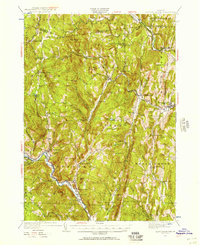
1930 Map of Saxtons River
USGS Topo · Published 1957About this map
The West River and Saxtons River valleys define this 1930s landscape, where rural Vermont life is recorded through a network of small settlements and district schoolhouses. Several distinct hamlets like Grafton, Cambridgeport, and West Townshend are linked by winding valley roads, while the Rutland Railroad traces the northern corridor through Bartonsville. The map illustrates a period when local infrastructure was highly decentralized, noted by numerous named schools such as Walker Sch, Valley Sch, and No 3 Sch scattered across the uplands.
Find a feature on this map
100 named features on this map. Tap any name to fly to it.
Don’t see what you’re looking for? This feature index may not catch every label — zoom into the map to look around manually.
Map Details
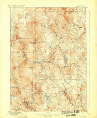
Editions of this 1930 Saxtons River Map
2 editions found

Other maps of this area

1889 · Wilmington
USGS Topo · 1:62,500

1891 · Wilmington
USGS Topo · 1:62,500

1891 · Brattleboro
USGS Topo · 1:62,500

1893 · Wallingford
USGS Topo · 1:62,500

1893 · Brattleboro
USGS Topo · 1:62,500

1894 · Londonderry
USGS Topo · 1:62,500

1898 · Keene
USGS Topo · 1:62,500

1899 · Londonderry
USGS Topo · 1:62,500
1899 · Wilmington
USGS Topo · 1:62,500

1926 · Claremont
USGS Topo · 1:62,500