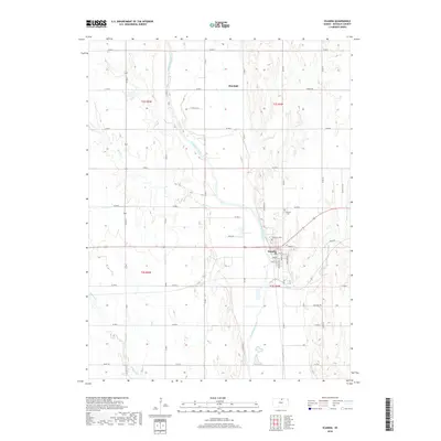
2018 Map of Scandia
USGS Topo · Published 2018About this map
The Republican River carves a diagonal path through this portion of Republic County, defining the agricultural landscape near Scandia. This settlement serves as a local hub, situated at the junction where Mud Cr meets the larger river valley. To the north, the small community of Sherdahl sits among a grid of section roads, illustrating the systematic land division of the Kansas plains. The map identifies key local landmarks for family historians, including the Riverview Cem overlooking the river and the Lutheran Cem further east. The surrounding terrain is characterized by winding creek beds such as School Cr and Beaver Cr, which break up the rectangular pattern of farmsteads and rural routes like Limestone Trl and Lincoln Rd.
Find a feature on this map
32 named features on this map. Tap any name to fly to it.
Don’t see what you’re looking for? This feature index may not catch every label — zoom into the map to look around manually.
Map Details
Editions of this 2018 Scandia Map
This is the sole edition of this map. No revisions or reprints were ever made.
Other maps of this area

1892 · Concordia
USGS Topo · 1:125,000

1955 · Manhattan
USGS Topo · 1:250,000

1956 · Manhattan
USGS Topo · 1:250,000

1957 · Manhattan
USGS Topo · 1:250,000

1965 · Concordia NW
USGS Topo · 1:24,000

1965 · Kackley
USGS Topo · 1:24,000

1966 · Scandia
USGS Topo · 1:24,000
1966 · Belleville
USGS Topo · 1:24,000
1968 · Jamestown NW
USGS Topo · 1:24,000
1968 · Belleville NW
USGS Topo · 1:24,000