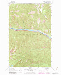
1963 Map of Scenery Mountain
USGS Topo · Published 1984About this map
The Kootenai River carves a deep valley through the heart of this landscape, flanked by the high peaks of the Cabinet Mountains and Kootenai National Forest. In the early 1960s, the Burlington Northern railroad served as the primary industrial corridor along the riverbank, passing through a terrain defined by steep drainage systems like China Creek and Lamoka Creek. The southern portion of the map transitions into the high-altitude terrain of the Cabinet Mountains Wilderness Boundary, where the Upper Cedar Lake and Lower Cedar Lake sit below the heights of Grambauer Mountain. This survey captures a moment of active forest management and resource extraction, evidenced by the network of Pack Trails and a Gravel Pit near the river bend.
Find a feature on this map
31 named features on this map. Tap any name to fly to it.
Don’t see what you’re looking for? This feature index may not catch every label — zoom into the map to look around manually.
Map Details
Editions of this 1963 Scenery Mountain Map
2 editions found
Other maps of this area

1920 · Libby
USGS Topo · 1:125,000

1930 · Libby
USGS Topo · 1:125,000

1932 · Libby
USGS Topo · 1:125,000

1957 · Kalispell
USGS Topo · 1:250,000

1960 · Kalispell
USGS Topo · 1:250,000

1961 · Kalispell
USGS Topo · 1:250,000

1963 · Scenery Mountain
USGS Topo · 1:24,000

1963 · Turner Mountain
USGS Topo · 1:24,000

1963 · Pulpit Mountain
USGS Topo · 1:24,000

1963 · Treasure Mountain
USGS Topo · 1:24,000