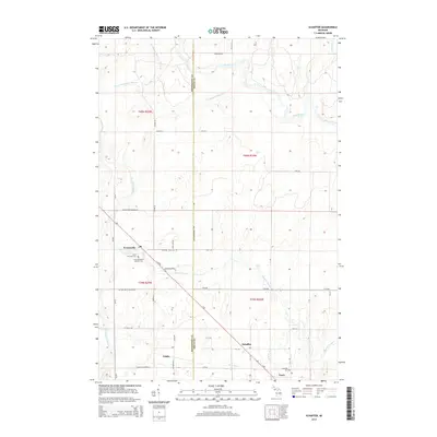
2014 Map of Schaffer
USGS Topo · Published 2014About this map
Perronville and Schaffer anchor this portion of the Upper Peninsula, where the landscape is defined by the winding paths of the Ford River and Bark River. The settlement pattern follows a clear northwest-to-southeast diagonal, traced by F Rd and the former rail corridor that links Perronville down to Tesch. This corridor represents the historical backbone of local transport, connecting the small communities and rural outposts that once relied on these routes for movement. Local history and genealogy are preserved at sites like Saint Michael's Catholic Cem and the Schaffer Cem, which serve as quiet landmarks for the families of the area. The terrain is further etched by numerous tributaries including Tenmile Creek, Twentyfour Mile Cr, and Fortyseven Mile Cr, illustrating the dense hydrological network of Delta and Menominee counties.
Find a feature on this map
54 named features on this map. Tap any name to fly to it.
Don’t see what you’re looking for? This feature index may not catch every label — zoom into the map to look around manually.
Map Details
Editions of this 2014 Schaffer Map
This is the sole edition of this map. No revisions or reprints were ever made.
Other maps of this area

1932 · Bark River NE
USGS Topo · 1:31,680

1932 · Whitney NE
USGS Topo · 1:31,680

1932 · Whitney SE
USGS Topo · 1:31,680

1932 · Gladstone SW
USGS Topo · 1:31,680

1932 · Gladstone NW
USGS Topo · 1:31,680

1950 · Gladstone NW
USGS Topo · 1:31,680

1954 · Escanaba
USGS Topo · 1:250,000

1957 · Escanaba
USGS Topo · 1:250,000

1958 · Escanaba
USGS Topo · 1:250,000

1958 · Gladstone
USGS Topo · 1:62,500
Featured Places
- Ford River Township, MI
- Harris Township, MI
- Perronville, MI
- Bark River Township, MI
- Escanaba Township, MI