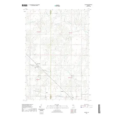
2019 Map of Schaffer
USGS Topo · Published 2019About this map
Perronville and Schaffer anchor this landscape along the border of Delta and Menominee Counties, where small settlements are connected by a network of rural roads and watercourses. The area is defined by its drainage into the Ford River and the Bark River systems, with Tenmile Creek and Twentyfour Mile Cr cutting through the terrain. Evidence of local community life is visible at the Saint Michaels Catholic Church and its adjacent Saint Michaels Catholic Cem near Perronville, as well as the Schaffer Cem further east. A significant geographic feature is the Escanaba to Hermansville State Trail, which follows an old rail grade through Eustis and Tesch, illustrating the transformation of industrial transportation routes into modern recreational corridors in this part of the Upper Peninsula.
Find a feature on this map
56 named features on this map. Tap any name to fly to it.
Don’t see what you’re looking for? This feature index may not catch every label — zoom into the map to look around manually.
Map Details
Editions of this 2019 Schaffer Map
This is the sole edition of this map. No revisions or reprints were ever made.
Other maps of this area

1932 · Bark River NE
USGS Topo · 1:31,680

1932 · Whitney NE
USGS Topo · 1:31,680

1932 · Whitney SE
USGS Topo · 1:31,680

1932 · Gladstone SW
USGS Topo · 1:31,680

1932 · Gladstone NW
USGS Topo · 1:31,680

1950 · Gladstone NW
USGS Topo · 1:31,680

1954 · Escanaba
USGS Topo · 1:250,000

1957 · Escanaba
USGS Topo · 1:250,000

1958 · Escanaba
USGS Topo · 1:250,000

1958 · Gladstone
USGS Topo · 1:62,500
Featured Places
- Ford River Township, MI
- Harris Township, MI
- Perronville, MI
- Bark River Township, MI
- Escanaba Township, MI