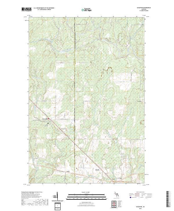
2023 Map of Schaffer
USGS Topo · Published 2023About this map
Perronville and Schaffer serve as the primary nodes of settlement in this part of the Upper Peninsula, where the landscape is defined by the winding paths of the Ford River and Bark River. The map reveals a specialized transportation network following former railroad corridors, now designated as the Felch Grade Route Trl and the Escanaba To Hermansville State Trl. These routes pass through the smaller hamlets of Eustis and Tesch, providing a clear view of the region's transition from an industrial timber-and-rail economy to one focused on recreation and state-managed trails. Local genealogy is anchored by established sites like Saint Michael's Catholic Cem near the intersection of G 30 RD and Swede Road Number 47. Numerous smaller waterways, including Tenmile Creek and Twentyfour Mile Creek, lace through the wetlands and woodlots along the Menominee and Delta County line.
Find a feature on this map
45 named features on this map. Tap any name to fly to it.
Don’t see what you’re looking for? This feature index may not catch every label — zoom into the map to look around manually.
Map Details
Editions of this 2023 Schaffer Map
This is the sole edition of this map. No revisions or reprints were ever made.
Other maps of this area

1932 · Bark River NE
USGS Topo · 1:31,680

1932 · Whitney NE
USGS Topo · 1:31,680

1932 · Whitney SE
USGS Topo · 1:31,680

1932 · Gladstone SW
USGS Topo · 1:31,680

1932 · Gladstone NW
USGS Topo · 1:31,680

1950 · Gladstone NW
USGS Topo · 1:31,680

1954 · Escanaba
USGS Topo · 1:250,000

1957 · Escanaba
USGS Topo · 1:250,000

1958 · Escanaba
USGS Topo · 1:250,000

1958 · Gladstone
USGS Topo · 1:62,500