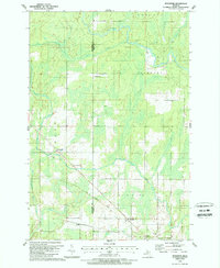
1989 Map of Schaffer
USGS Topo · Published 1989About this map
The boundary between Menominee Co and Delta Co cuts through this landscape of the Upper Peninsula, where the Ford River and Bark River wind through heavy wetlands and forested tracts. Small settlements like Perronville and Schaffer are linked by a transportation network that includes an Old Railroad Grade and local landmarks such as the Townhall and a small Landing Strip. Local genealogy and community life center around sites like St Michaels Cem and the Schaffer Cem, documenting the persistence of these rural outposts. The map reveals a region defined by its watercourses, including Tenmile Creek and West Branch Twentyfour Mile Creek, which dictate the drainage and development patterns across the townships of Cornell, Escanaba, and Bark River.
Find a feature on this map
23 named features on this map. Tap any name to fly to it.
Don’t see what you’re looking for? This feature index may not catch every label — zoom into the map to look around manually.
Map Details
Editions of this 1989 Schaffer Map
This is the sole edition of this map. No revisions or reprints were ever made.
Other maps of this area

1932 · Bark River NE
USGS Topo · 1:31,680

1932 · Whitney NE
USGS Topo · 1:31,680

1932 · Whitney SE
USGS Topo · 1:31,680

1932 · Gladstone SW
USGS Topo · 1:31,680

1932 · Gladstone NW
USGS Topo · 1:31,680

1950 · Gladstone NW
USGS Topo · 1:31,680

1954 · Escanaba
USGS Topo · 1:250,000

1957 · Escanaba
USGS Topo · 1:250,000

1958 · Escanaba
USGS Topo · 1:250,000

1958 · Gladstone
USGS Topo · 1:62,500