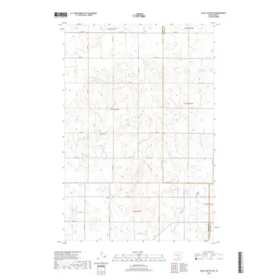
2018 Map of Schell Buttes SW
USGS Topo · Published 2018About this map
Saint Michaels Catholic Cemetery and Saint Joseph Cemetery stand as quiet landmarks within this rural North Dakota landscape, reflecting the heritage of the families who settled this region of Logan County. The terrain is defined by a grid of agricultural section lines, including 72nd St SE and 80th St SE, which facilitate movement between the sparsely populated farmsteads. Natural drainages like Longlake Cr and the meandering Beaver Creek provide vital water sources and topographical variation in an otherwise orderly township and range system. This 2018 survey documents the enduring layout of rural routes like Hulm Ln and the administrative boundaries where Emmons and Logan counties meet, illustrating the intersection of natural watercourses and human-imposed boundaries in the northern plains.
Find a feature on this map
19 named features on this map. Tap any name to fly to it.
Don’t see what you’re looking for? This feature index may not catch every label — zoom into the map to look around manually.
Map Details
Editions of this 2018 Schell Buttes SW Map
This is the sole edition of this map. No revisions or reprints were ever made.
Other maps of this area

1953 · Jamestown
USGS Topo · 1:250,000

1954 · Bismarck
USGS Topo · 1:250,000

1956 · Jamestown
USGS Topo · 1:250,000

1958 · Bismarck
USGS Topo · 1:250,000

1975 · Linton NE
USGS Topo · 1:24,000

1979 · Schell Buttes
USGS Topo · 1:24,000

1979 · Senger Lake North
USGS Topo · 1:24,000

1979 · Schell Buttes SW
USGS Topo · 1:24,000

1979 · Schell Buttes NW
USGS Topo · 1:24,000

1979 · McKenna Lake South
USGS Topo · 1:24,000