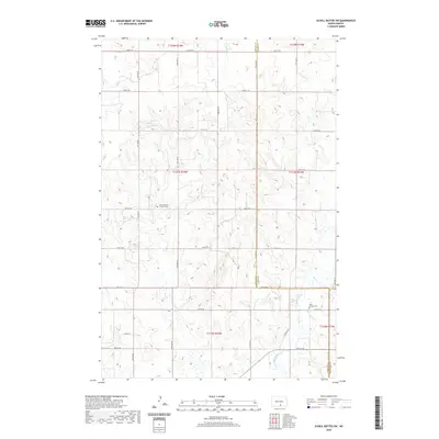
2020 Map of Schell Buttes SW
USGS Topo · Published 2020About this map
The agrarian landscape of Logan County is defined by a rhythmic grid of rural roads and the subtle drainage patterns of Long Lake Cr and Beaver Cr. These prairies are dotted with landmarks vital to local genealogy, notably Saint Michaels Catholic Cem and Saint Joseph Cem, which serve as permanent records of the early settlement families in this part of North Dakota. The map illustrates a strictly organized section-line road system, including Hulm Ln, that intersects the rolling topography. Political boundaries are clearly marked where Logan County meets Emmons County, providing a precise look at the township and range divisions that have governed this land since the initial homesteading era.
Find a feature on this map
32 named features on this map. Tap any name to fly to it.
Don’t see what you’re looking for? This feature index may not catch every label — zoom into the map to look around manually.
Map Details
Editions of this 2020 Schell Buttes SW Map
This is the sole edition of this map. No revisions or reprints were ever made.
Other maps of this area

1953 · Jamestown
USGS Topo · 1:250,000

1954 · Bismarck
USGS Topo · 1:250,000

1956 · Jamestown
USGS Topo · 1:250,000

1958 · Bismarck
USGS Topo · 1:250,000

1975 · Linton NE
USGS Topo · 1:24,000

1979 · Schell Buttes
USGS Topo · 1:24,000

1979 · Senger Lake North
USGS Topo · 1:24,000

1979 · Schell Buttes SW
USGS Topo · 1:24,000

1979 · Schell Buttes NW
USGS Topo · 1:24,000

1979 · McKenna Lake South
USGS Topo · 1:24,000