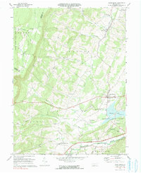
1971 Map of Schellsburg
USGS Topo · Published 1991About this map
Shawnee State Park dominates the southeastern quadrant of this terrain, centered on the waters of Shawnee Lake. The landscape transition from the high elevations of Chestnut Ridge down to the Raystown Branch Juniata River valley illustrates a classic Appalachian settlement pattern, where small villages like Schellsburg and New Paris are situated along the lower slopes and valley floors. Smaller hamlets such as Helixville, New Buena Vista, and Daley reflect the early agricultural and community hubs of Napier and Harrison townships.
Find a feature on this map
40 named features on this map. Tap any name to fly to it.
Don’t see what you’re looking for? This feature index may not catch every label — zoom into the map to look around manually.
Map Details
Editions of this 1971 Schellsburg Map
3 editions found
Other maps of this area

1908 · Bedford
USGS Topo · 1:62,500

1910 · Bedford
USGS Topo · 1:62,500

1914 · Windber
USGS Topo · 1:62,500

1916 · Windber
USGS Topo · 1:62,500

1923 · Berlin
USGS Topo · 1:48,000

1927 · Hyndman
USGS Topo · 1:62,500

1929 · Berlin
USGS Topo · 1:62,500

1931 · Hyndman
USGS Topo · 1:62,500

1944 · Hyndman
USGS Topo · 1:62,500

1944 · Windber
USGS Topo · 1:62,500