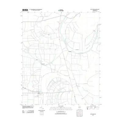
2012 Map of Schlater
USGS Topo · Published 2012About this map
Schlater anchors this Delta landscape, characterized by a complex network of agricultural roads and drainage features typical of the Yazoo Basin. The map details the transition from the settlement at McNutt, featuring the McNutt Cem, to the rural communities of Highlandale and Sunnyside. A notable geographic feature is the Eutaw Bend of the river, where Eutaw Bend Landing once served as a vital point of transit. Numerous small family or community burial grounds, such as Watkins Cem, Shiloh Cem, and Humphrey Cem, are scattered across the terrain, offering essential data points for local genealogists. The presence of Marsh Bayou and various drainage canals illustrates the intensive water management required to maintain the surrounding productive farmland, while historic routes like Moores Lake Store Rd suggest former centers of local commerce.
Find a feature on this map
56 named features on this map. Tap any name to fly to it.
Don’t see what you’re looking for? This feature index may not catch every label — zoom into the map to look around manually.
Map Details
Editions of this 2012 Schlater Map
This is the sole edition of this map. No revisions or reprints were ever made.
Other maps of this area

1931 · Schlater
USGS Topo · 1:48,000

1931 · Sumner
USGS Topo · 1:48,000

1932 · Philipp
USGS Topo · 1:48,000

1934 · Schlater
USGS Topo · 1:62,500

1935 · Sumner
USGS Topo · 1:62,500

1935 · Philipp
USGS Topo · 1:62,500

1936 · Greenwood
USGS Topo · 1:62,500

1939 · Schlater
USGS Topo · 1:62,500

1939 · Sumner
USGS Topo · 1:62,500

1939 · Philipp
USGS Topo · 1:62,500