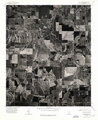
1974 Map of Schlater SW
USGS Topo · Published 1975About this map
The River meanders through the heart of this Leflore County landscape, creating a complex series of oxbows and remnant channels that define the agricultural pattern of the Mississippi Delta in the mid-1970s. This orthophotoquad reveals the stark geometry of large-scale land clearing and field preparation, where the natural curvature of old watercourses contrasts with the rigid, rectangular boundaries of modern farming. The intricate texture of the photoimagery captures the specific state of the bottomlands just after the harvest season in early October, showing the transition between riparian vegetation and the expansive, cleared acreage that dominates the region's economy.
Find a feature on this map
1 named feature on this map. Tap any name to fly to it.
Don’t see what you’re looking for? This feature index may not catch every label — zoom into the map to look around manually.
Map Details
Editions of this 1974 Schlater SW Map
This is the sole edition of this map. No revisions or reprints were ever made.
Other maps of this area

1931 · Schlater
USGS Topo · 1:48,000

1934 · Cleveland
USGS Topo · 1:62,500

1934 · Schlater
USGS Topo · 1:62,500

1939 · Schlater
USGS Topo · 1:62,500

1940 · Baird
USGS Topo · 1:62,500

1940 · Cleveland
USGS Topo · 1:62,500

1953 · Greenwood
USGS Topo · 1:250,000

1956 · Greenwood
USGS Topo · 1:250,000

1961 · Mossy Lake
USGS Topo · 1:62,500
1961 · Schlater
USGS Topo · 1:62,500