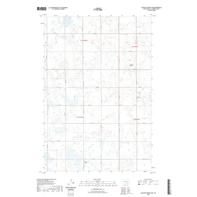
2020 Map of Schlecht-Weixel Dam
USGS Topo · Published 2020About this map
The prairie landscape of LaMoure County is defined by a vast network of wetlands and small glacial potholes that dot the townships of this North Dakota region. Central to the local geography is the Schlecht-Weixel Dam, which manages the flow of Maple Cr as it winds through the eastern portion of the survey. The rectangular grid of section lines and gravel roads, such as Co Rd 66 and Co Rd 34, structures the rural agricultural space, connecting isolated farmsteads across the undulating plains.
Find a feature on this map
24 named features on this map. Tap any name to fly to it.
Don’t see what you’re looking for? This feature index may not catch every label — zoom into the map to look around manually.
Map Details
Editions of this 2020 Schlecht-Weixel Dam Map
This is the sole edition of this map. No revisions or reprints were ever made.
Other maps of this area

1896 · Jamestown
USGS Topo · 1:125,000

1896 · Edgeley
USGS Topo · 1:125,000

1925 · Edgeley
USGS Topo · 1:125,000

1953 · Jamestown
USGS Topo · 1:250,000

1953 · Jud
USGS Topo · 1:24,000

1953 · Jud SE
USGS Topo · 1:24,000

1956 · Jamestown
USGS Topo · 1:250,000

1982 · Fredonia
USGS Topo · 1:24,000

1982 · Schlecht-Weixel Dam
USGS Topo · 1:24,000

1982 · Deisem
USGS Topo · 1:24,000