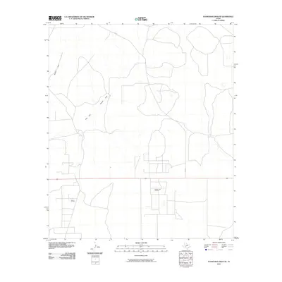
2010 Map of Schneeman Draw NE
USGS Topo · Published 2010About this map
Midway Lane Oil Field and the Elkhorn Oil Field define the industrial footprint of this Crockett County landscape during the first decade of the 21st century. The map depicts a territory where the economy is driven by energy extraction, with a grid of service roads and well sites etched into the arid terrain. Natural drainage follows the path of Howard Draw and its East Fork Howard Draw, which cut through the open country. Local transportation is centered on Co RD 205, providing the primary access through this sparsely populated region. This survey captures a specific moment in the evolution of the West Texas oil industry, illustrating how modern infrastructure overlays the natural arroyo systems of the Edwards Plateau.
Find a feature on this map
5 named features on this map. Tap any name to fly to it.
Don’t see what you’re looking for? This feature index may not catch every label — zoom into the map to look around manually.
Map Details
Editions of this 2010 Schneeman Draw NE Map
This is the sole edition of this map. No revisions or reprints were ever made.
Other maps of this area

1920 · Big Lake
USGS Topo · 1:62,500

1920 · Barnhart
USGS Topo · 1:62,500

1922 · Big Lake
USGS Topo · 1:62,500

1922 · Barnhart
USGS Topo · 1:62,500

1954 · Sonora
USGS Topo · 1:250,000

1954 · San Angelo
USGS Topo · 1:250,000

1958 · Sonora
USGS Topo · 1:250,000

1958 · San Angelo
USGS Topo · 1:250,000

1965 · San Angelo
USGS Topo · 1:250,000

1967 · Schneeman Draw NW
USGS Topo · 1:24,000