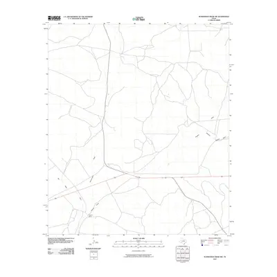
2010 Map of Schneeman Draw NW
USGS Topo · Published 2010About this map
Fogarty Ranch stands as a focal point in this high-desert landscape of Crockett County, marking the human footprint in a region defined by its ephemeral waterways. The geography is characterized by an extensive network of dry washes, most notably Schneeman Draw and the broad reaches of Howard Draw. These drainage patterns, including the East Fork Howard Draw and Bill West Draw, illustrate the natural irrigation and erosion paths that have historically dictated ranch boundaries and transportation routes through this part of West Texas. The sparse distribution of named locations emphasizes the isolation and specialized land use of the era, where family ranching operations served as the primary landmarks in an otherwise open range.
Find a feature on this map
5 named features on this map. Tap any name to fly to it.
Don’t see what you’re looking for? This feature index may not catch every label — zoom into the map to look around manually.
Map Details
Editions of this 2010 Schneeman Draw NW Map
This is the sole edition of this map. No revisions or reprints were ever made.
Other maps of this area

1920 · Big Lake
USGS Topo · 1:62,500

1922 · Big Lake
USGS Topo · 1:62,500

1928 · Rankin
USGS Topo · 1:125,000

1929 · Sheffield
USGS Topo · 1:125,000

1954 · Sonora
USGS Topo · 1:250,000

1954 · San Angelo
USGS Topo · 1:250,000

1958 · Sonora
USGS Topo · 1:250,000

1958 · San Angelo
USGS Topo · 1:250,000

1965 · San Angelo
USGS Topo · 1:250,000

1967 · Owens Creek SE
USGS Topo · 1:24,000