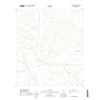
2019 Map of Schneeman Draw NW
USGS Topo · Published 2019About this map
Schneemann Draw and Bill West Draw carve through this high desert terrain in Crockett County, illustrating the complex drainage patterns of the Texas Edwards Plateau. This 2019 survey, produced by the U.S. Geological Survey, shows a landscape dominated by topographic relief and dry washes. The transportation network is defined by state-maintained ranch-to-market roads, including Ranch Rd 33 and Ranch Rd 865, which provide access to the vast ranch lands of the region. The confluence of drainage systems is evident where the East Fork Howard Draw meets the main channel of Howard Draw, a feature central to the local geography. These labels and the precise contour lines offer insight into the hydrological movement across this arid territory, documenting the relationship between modern infrastructure and natural landforms.
Find a feature on this map
7 named features on this map. Tap any name to fly to it.
Don’t see what you’re looking for? This feature index may not catch every label — zoom into the map to look around manually.
Map Details
Editions of this 2019 Schneeman Draw NW Map
This is the sole edition of this map. No revisions or reprints were ever made.
Other maps of this area

1920 · Big Lake
USGS Topo · 1:62,500

1922 · Big Lake
USGS Topo · 1:62,500

1928 · Rankin
USGS Topo · 1:125,000

1929 · Sheffield
USGS Topo · 1:125,000

1954 · Sonora
USGS Topo · 1:250,000

1954 · San Angelo
USGS Topo · 1:250,000

1958 · Sonora
USGS Topo · 1:250,000

1958 · San Angelo
USGS Topo · 1:250,000

1965 · San Angelo
USGS Topo · 1:250,000

1967 · Owens Creek SE
USGS Topo · 1:24,000