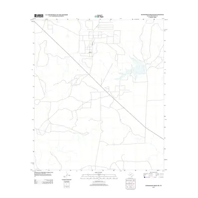
2012 Map of Schneeman Draw SE
USGS Topo · Published 2012About this map
Vaughn Oil Field anchors this portion of West Texas, reflecting the industrial character of the Permian Basin region during the early twenty-first century. The landscape is defined by the infrastructure of energy extraction, with a network of service roads and well pads intersecting the arid terrain. Co Rd 204 provides one of the few primary access points through this sector of Crockett County, connecting the scattered operations across the draws and plateaus. This 2012 survey illustrates the modern evolution of the Texas oil patch, where the historic ranching landscape has been heavily overlaid by contemporary resource development and high-precision mapping data.
Find a feature on this map
2 named features on this map. Tap any name to fly to it.
Don’t see what you’re looking for? This feature index may not catch every label — zoom into the map to look around manually.
Map Details
Editions of this 2012 Schneeman Draw SE Map
This is the sole edition of this map. No revisions or reprints were ever made.
Other maps of this area

1954 · Sonora
USGS Topo · 1:250,000

1958 · Sonora
USGS Topo · 1:250,000

1967 · Ozona
USGS Topo · 1:24,000

1967 · Schneeman Draw NW
USGS Topo · 1:24,000
1967 · Schneeman Draw NE
USGS Topo · 1:24,000

1967 · Pikes Peak
USGS Topo · 1:24,000
1967 · Schneeman Draw SW
USGS Topo · 1:24,000

1967 · Indio Hill
USGS Topo · 1:24,000

1967 · Double Mill Draw NW
USGS Topo · 1:24,000
1967 · Schneeman Draw SE
USGS Topo · 1:24,000