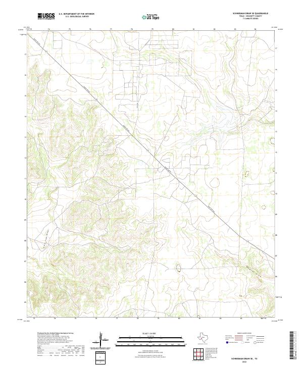
2022 Map of Schneeman Draw SE
USGS Topo · Published 2022About this map
Ranch Rd 865 cuts a diagonal path across this Crockett County landscape, serving as the primary corridor through a region defined by its complex drainage systems. The terrain is deeply etched by ephemeral waterways, most notably Pikes Peak Draw in the southwest and Newton Draw to the southeast. These features illustrate the characteristic West Texas geography where dry creek beds become critical conduits during seasonal rains. Local transport is further supported by Co Rd 204, which provides access to the interior ranch lands north of the main thoroughfare. The map reveals a sparsely populated area where the road network is dictated by the natural contours of the draws, reflecting a land usage focused on large-scale ranching and resource management.
Find a feature on this map
4 named features on this map. Tap any name to fly to it.
Don’t see what you’re looking for? This feature index may not catch every label — zoom into the map to look around manually.
Map Details
Editions of this 2022 Schneeman Draw SE Map
This is the sole edition of this map. No revisions or reprints were ever made.
Other maps of this area

1954 · Sonora
USGS Topo · 1:250,000

1958 · Sonora
USGS Topo · 1:250,000

1967 · Ozona
USGS Topo · 1:24,000

1967 · Schneeman Draw NW
USGS Topo · 1:24,000
1967 · Schneeman Draw NE
USGS Topo · 1:24,000

1967 · Pikes Peak
USGS Topo · 1:24,000
1967 · Schneeman Draw SW
USGS Topo · 1:24,000

1967 · Indio Hill
USGS Topo · 1:24,000

1967 · Double Mill Draw NW
USGS Topo · 1:24,000
1967 · Schneeman Draw SE
USGS Topo · 1:24,000