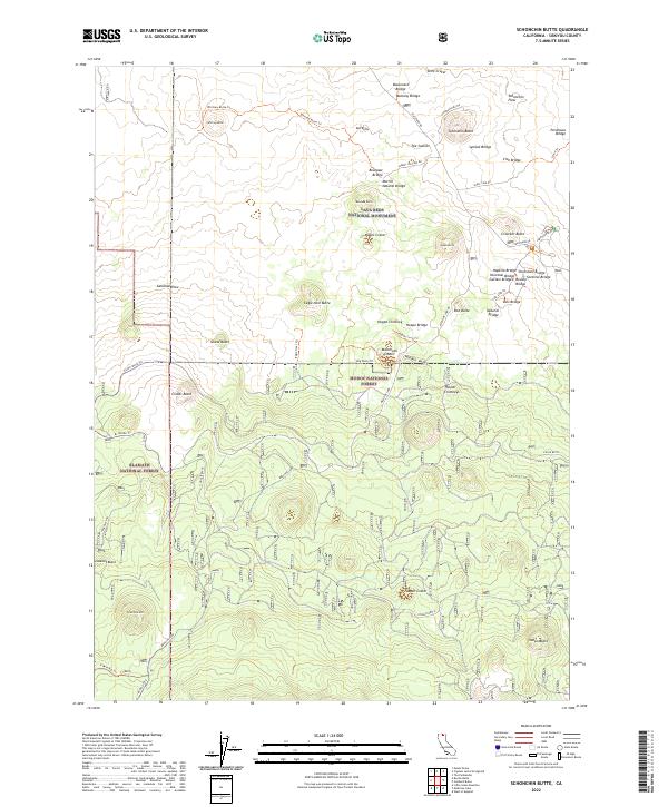
2022 Map of Schonchin Butte
USGS Topo · Published 2022About this map
Lava Beds National Monument anchors this volcanic landscape, where the high-elevation terrain of Siskiyou County is defined by extensive lava flows and cinder cones. The map traces the rugged Schonchin Flow and Callahan Flow, revealing a complex geological history through features like The Castles and numerous named buttes. Evidence of the subterranean world is found in names like Merrill Ice Cave Rd and the Merrill Natural Bridge.
Find a feature on this map
59 named features on this map. Tap any name to fly to it.
Don’t see what you’re looking for? This feature index may not catch every label — zoom into the map to look around manually.
Map Details
Editions of this 2022 Schonchin Butte Map
This is the sole edition of this map. No revisions or reprints were ever made.
Other maps of this area

1886 · Modoc Lava Bed
USGS Topo · 1:250,000

1892 · Modoc Lava-Bed
USGS Topo · 1:250,000

1950 · Mt. Dome
USGS Topo · 1:62,500

1951 · Tulelake
USGS Topo · 1:62,500

1952 · Timber Mountain
USGS Topo · 1:62,500

1952 · Medicine Lake
USGS Topo · 1:62,500

1954 · Alturas
USGS Topo · 1:250,000

1958 · Alturas
USGS Topo · 1:250,000

1962 · Alturas
USGS Topo · 1:250,000

1965 · Alturas
USGS Topo · 1:250,000