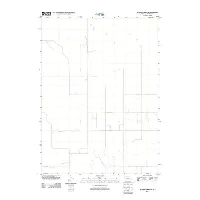
2011 Map of School Number 20
USGS Topo · Published 2011About this map
Old State Hwy 101 cuts across this section of Wheeler County, tracing the legacy of earlier transportation corridors through the Nebraska Sandhills. The landscape is defined by its sparse, grid-aligned rural road network, indicating the vast, open tracts of agricultural or ranching land that characterize the region. Toward the southern border, Pibel Lake Rd provides access to local recreation and small seasonal settlements, while scattered ephemeral ponds dot the northern terrain. This survey provides a baseline of the local infrastructure and land use patterns as they existed in the early twenty-first century, useful for those researching property boundaries or the evolution of state highway designations in central Nebraska.
Find a feature on this map
2 named features on this map. Tap any name to fly to it.
Don’t see what you’re looking for? This feature index may not catch every label — zoom into the map to look around manually.
Map Details
Editions of this 2011 School Number 20 Map
This is the sole edition of this map. No revisions or reprints were ever made.
Other maps of this area

1954 · Greeley NE
USGS Topo · 1:24,000

1954 · Spalding
USGS Topo · 1:24,000

1954 · Spalding NW
USGS Topo · 1:24,000

1954 · Bartlett SE
USGS Topo · 1:24,000

1954 · Bartlett
USGS Topo · 1:24,000

1955 · Broken Bow
USGS Topo · 1:250,000

1956 · Broken Bow
USGS Topo · 1:250,000

1960 · Spalding 2 SW
USGS Topo · 1:24,000

1960 · Spalding 2 NW
USGS Topo · 1:24,000

1960 · Spalding 2 NE
USGS Topo · 1:24,000