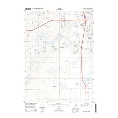
2014 Map of Schoolcraft NW
USGS Topo · Published 2014About this map
Kalamazoo Valley Community Coll and the growing residential landscape of Texas Corners define this area southwest of Kalamazoo. The terrain is characterized by a dense cluster of kettle lakes, including Eagle Lake, Crooked Lake, and the larger Hampton Lake near the border of Portage. This glacial topography influenced the placement of early rural cemeteries such as Pretty Lake Cem and Hope Cem, which remain as markers of the area's pioneer history amidst modern development. Small aviation facilities like Whitcomb Field Airport and Perry Airport are dotted across the landscape, reflecting the suburban and light-industrial expansion that followed the established road grid. Along the W Fork Portage Cr, the Atwater Millpond serves as a reminder of early water-power utilization in the drainage system that feeds toward the regional river networks.
Find a feature on this map
138 named features on this map. Tap any name to fly to it.
Don’t see what you’re looking for? This feature index may not catch every label — zoom into the map to look around manually.
Map Details
Editions of this 2014 Schoolcraft NW Map
This is the sole edition of this map. No revisions or reprints were ever made.
Other maps of this area

1916 · Kalamazoo
USGS Topo · 1:62,500

1918 · Kalamazoo
USGS Topo · 1:62,500

1922 · Schoolcraft
USGS Topo · 1:62,500

1943 · Kalamazoo
USGS Topo · 1:62,500

1943 · Schoolcraft
USGS Topo · 1:62,500

1944 · Marcellus
USGS Topo · 1:62,500

1946 · Marcellus
USGS Topo · 1:62,500

1946 · Gobles
USGS Topo · 1:62,500

1948 · Gobles
USGS Topo · 1:62,500

1949 · Gobles
USGS Topo · 1:62,500