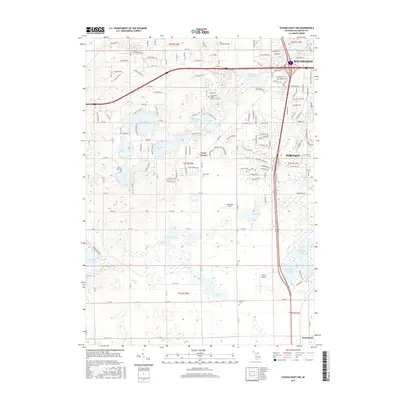
2017 Map of Schoolcraft NW
USGS Topo · Published 2017About this map
Texas Corners serves as a central hub in this landscape southwest of Kalamazoo, where a high density of glacial kettle lakes defines the topography. The suburban and rural transition is evident through the campus of Kalamazoo Valley Community College and several small aviation landmarks including Perry Airport and Whitcomb Field. For those researching local history, the map identifies several burial grounds such as Pretty Lake Cem, Hope Cem, and Harrison Cem. The aquatic landscape is diverse, ranging from the large Eagle Lake and Crooked Lake to the industrial history suggested by Atwater Millpond. This area near Portage reflects the modern development of Kalamazoo County while maintaining clear identifiers of its natural water-bound geography and earlier township settlements.
Find a feature on this map
104 named features on this map. Tap any name to fly to it.
Don’t see what you’re looking for? This feature index may not catch every label — zoom into the map to look around manually.
Map Details
Editions of this 2017 Schoolcraft NW Map
This is the sole edition of this map. No revisions or reprints were ever made.
Other maps of this area

1916 · Kalamazoo
USGS Topo · 1:62,500

1918 · Kalamazoo
USGS Topo · 1:62,500

1922 · Schoolcraft
USGS Topo · 1:62,500

1943 · Kalamazoo
USGS Topo · 1:62,500

1943 · Schoolcraft
USGS Topo · 1:62,500

1944 · Marcellus
USGS Topo · 1:62,500

1946 · Marcellus
USGS Topo · 1:62,500

1946 · Gobles
USGS Topo · 1:62,500

1948 · Gobles
USGS Topo · 1:62,500

1949 · Gobles
USGS Topo · 1:62,500