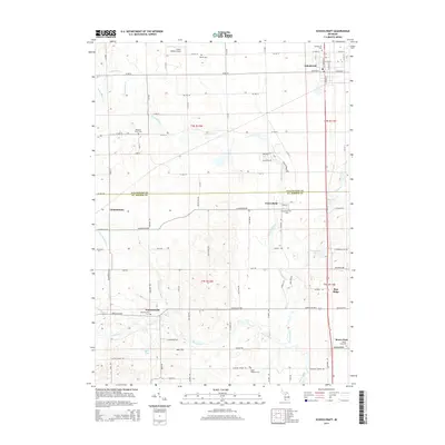
2014 Map of Schoolcraft
USGS Topo · Published 2014About this map
Prairie Ronde terrain characterizes this portion of southwest Michigan, where the boundary between Kalamazoo and St. Joseph counties divides a landscape of small agricultural settlements and winding waterways. The village of Schoolcraft sits at the northern edge, a structured grid defined by streets like W Eliza St and W Lyons St, while the community of Flowerfield occupies a more central position near the namesake Flowerfield Cr. Local history is deeply etched into the land through an unusually high density of burial grounds, including the Schoolcraft Cem, Shaver Cem, and the Upper Flatbush Cem. The drainage patterns are complex, featuring the Four County Drain and the southern flow of the Rocky River. Notable industrial and transportation landmarks include a Marl Pit near Ayers Lake and the Prairie Ronde Airport, illustrating the mix of traditional resource extraction and modern infrastructure in this rural corridor.
Find a feature on this map
57 named features on this map. Tap any name to fly to it.
Don’t see what you’re looking for? This feature index may not catch every label — zoom into the map to look around manually.
Map Details
Editions of this 2014 Schoolcraft Map
This is the sole edition of this map. No revisions or reprints were ever made.
Other maps of this area

1914 · Three Rivers
USGS Topo · 1:62,500

1916 · Three Rivers
USGS Topo · 1:62,500

1922 · Schoolcraft
USGS Topo · 1:62,500

1943 · Three Rivers
USGS Topo · 1:62,500

1943 · Schoolcraft
USGS Topo · 1:62,500

1944 · Marcellus
USGS Topo · 1:62,500

1946 · Marcellus
USGS Topo · 1:62,500

1948 · Vandalia
USGS Topo · 1:62,500

1949 · Vandalia
USGS Topo · 1:62,500

1953 · Fort Wayne
USGS Topo · 1:250,000